
Tunnel World turns 10: over 500 people celebrated the tenth anniversary of the Brenner Base Tunnel information centre
After its opening, the Brenner Base Tunnel (BBT) will provide, in many ways, a better connection between between Tyrol and Alto Adige, as well as between Northern and Southern Europe. With the BBT, a significant amount of freight transport will shift onto the railways, thereby significantly reducing traffic on the roads along the Alpine route.
For travellers, this means above all shorter travel times, more reliable train connections and other benefits.
Cities such as Innsbruck, Bolzano and Verona will be brought closer together, making rail travel more attractive than car journeys or short-haul flights.
Less heavy goods traffic on the motorways in the Inn Valley and Wipp Valley means fewer traffic jams, lower CO₂ emissions and a noticeable reduction in noise in the affected valleys.
Furthermore, the BBT will strengthen the economic links between Austria and Italy and beyond. Companies will be able to transport goods faster and more efficiently, and tourism will benefit from faster travel to their destinations.
The existing line over the Brenner Pass is operating at its maximum capacity and is no longer really suitable for modern freight transport due to its steep gradients and winding route.
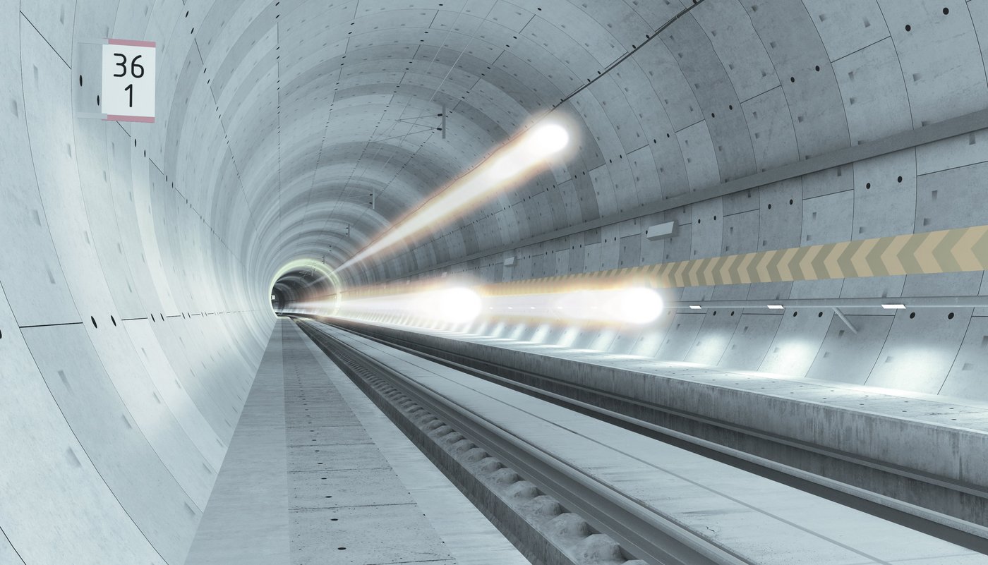
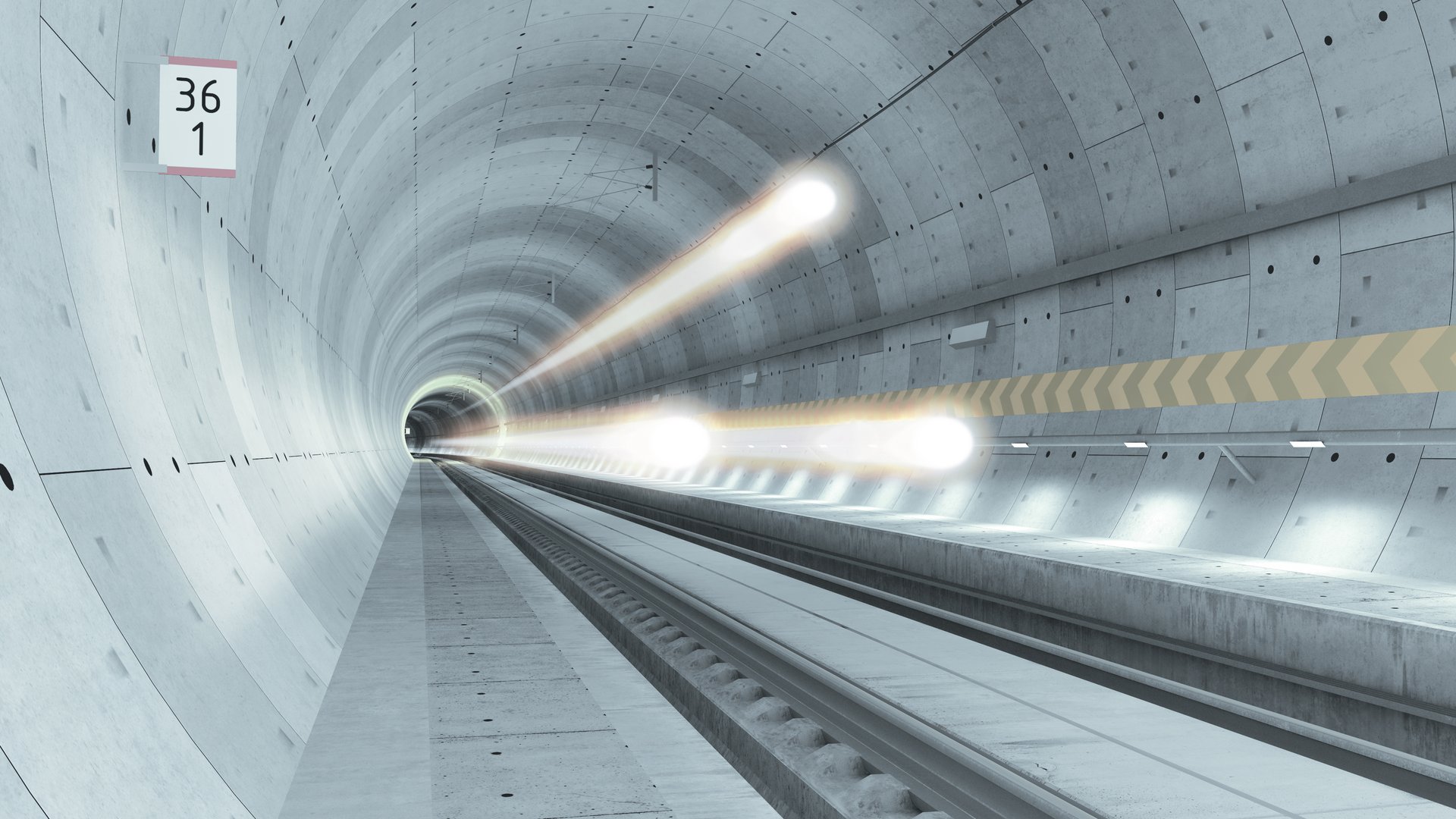
• The new low-gradient railway through the BBT allows for longer and heavier trains
• Travel times and noise pollution will be significantly reduced
• Compared to the route over the Brenner Pass, the tunnel route offers protection against natural hazards such as extreme weather events
• Instead of the entire lorry (traction unit and semi-trailer with goods), only the actual goods will be transported in containers
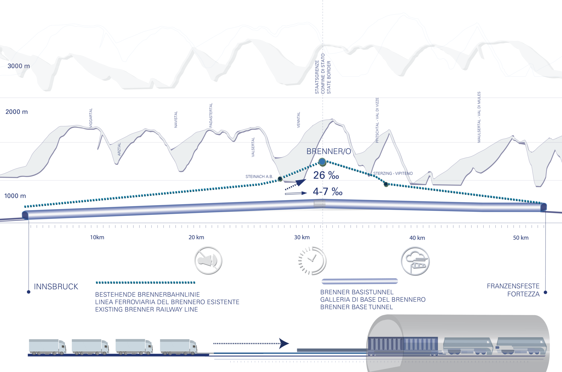
This is how long a passenger train will take to travel through the BBT. On the existing line, this journey takes 1 hour and 20 minutes.
This is how long a freight train will take to travel through the BBT. On the existing line, this journey takes 1 hour and 45 minutes.
740-metre long trains will be able to travel through the BBT. On the existing line, the maximum train length is 450 m.
1 locomotive will be sufficient to travel along the new line through the BBT. Currently, two to three are needed.
IN TOTAL, THE BBT TUNNEL SYSTEM WILL INCLUDE ABOUT 230 KILOMETRES OF TUNNELS.
![[Translate to EN:]](/fileadmin/_processed_/b/8/csm_Perspektive_von_der_Panoramaterrasse_93cdfd83b3.jpg "View from the panoramic terrace")
